Henry Coe State Park

Kelly Cabin Canyon Trail
Technical Difficulty:![]()
Physical Difficulty: ![]()
Singletrack: Yes. The park has over 30 miles of tight singletrack through stunningly beautiful and untouched wilderness. There is some required fireroad riding to get you in to the good stuff, but it’s definitely worth it.
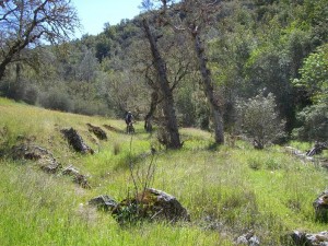
Description: Just south of San Jose and minutes from Gilroy, this state park offers some of the best singletrack in the bay area. Upon arriving to the park you feel like you’ve been transported hundreds of miles from civilization into a very remote location. There’s no cell phone coverage out here so it’s best to bring a riding buddy.
The park’s massive size at over 87,000 acres of open space allows for a number of different rides throughout the park. It also means that you should bring a map because getting lost can cause a real problem (unlike many of the smaller parks). Trails are usually marked, but some intersections might not be so if you have a GPS device, make sure to bring that too.
The terrain at this park is extremely mountainous, ranging from steep to rediculously steep. While there are some valleys that are relatively flat, most of the time you’ll either be ascending or descending which can make a 15 mile ride feel like 30 miles. The payoff is the wild-flowers, natural meadows, tree groves, and winding streams you’ll encounter along the way.
Spring and Fall are good times to ride this park as the winter can be extremely cold and the summer extremely hot. All singletrack trails are close for 48 hours after half an inch of rain, so make sure to check the weather for the previous couple of days when planning your trip.
Getting to the park: take Route 101 to Gilroy and exit on Leavesly Road. Head East for about a mile. Turn left on New Avenue just before the sharp right. Then take a right onto Roop road and follow the signs to Henry Coe. Here’s a Google map of the area.
Trail Maps: You can find trial maps on the Henry Coe website here. There’s also maps available from some GPS enthusiasts here.
Route: Coyote Creek to Kelly Lake and back
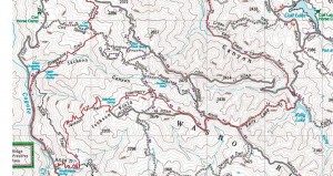
 Start at the Coyote Creek entrance. Make sure not to block the gate when you park and to make sure your vehicle is completely off the road. Take the Coit Road fire road up to Anza and then follow the rest of the route on the trail map to the left (click to enlarge). Note that the turnoff for Kelly Cabin Trail is marked by orange home-depot flags (as of April, 2009) and is easily missed. When you head out from Kelly Lake keep an eye to your right as it will come up in only a few hundred yards.
If you have a Garmin GPS you can download this route here.
[svgallery name=”Henry Coe 04-04-2009″]