Henry Coe State Park
Kelly Cabin Canyon Trail
Technical Difficulty:![]()
Physical Difficulty: ![]()
Singletrack: Yes. The park has over 30 miles of tight singletrack through stunningly beautiful and untouched wilderness. There is some required fireroad riding to get you in to the good stuff, but it’s definitely worth it.
Description: Just south of San Jose and minutes from Gilroy, this state park offers some of the best singletrack in the bay area. Upon arriving to the park you feel like you’ve been transported hundreds of miles from civilization into a very remote location. There’s no cell phone coverage out here so it’s best to bring a riding buddy.
The park’s massive size at over 87,000 acres of open space allows for a number of different rides throughout the park. It also means that you should bring a map because getting lost can cause a real problem (unlike many of the smaller parks). Trails are usually marked, but some intersections might not be so if you have a GPS device, make sure to bring that too.
The terrain at this park is extremely mountainous, ranging from steep to rediculously steep. While there are some valleys that are relatively flat, most of the time you’ll either be ascending or descending which can make a 15 mile ride feel like 30 miles. The payoff is the wild-flowers, natural meadows, tree groves, and winding streams you’ll encounter along the way.
Spring and Fall are good times to ride this park as the winter can be extremely cold and the summer extremely hot. All singletrack trails are close for 48 hours after half an inch of rain, so make sure to check the weather for the previous couple of days when planning your trip.
Getting to the park: take Route 101 to Gilroy and exit on Leavesly Road. Head East for about a mile. Turn left on New Avenue just before the sharp right. Then take a right onto Roop road and follow the signs to Henry Coe. Here’s a Google map of the area.
Trail Maps: You can find trial maps on the Henry Coe website here. There’s also maps available from some GPS enthusiasts here.
Route: Coyote Creek to Kelly Lake and back
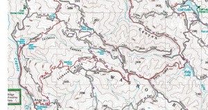 Start at the Coyote Creek entrance. Make sure not to block the gate when you park and to make sure your vehicle is completely off the road. Take the Coit Road fire road up to Anza and then follow the rest of the route on the trail map to the left (click to enlarge). Note that the turnoff for Kelly Cabin Trail is marked by orange home-depot flags (as of April, 2009) and is easily missed. When you head out from Kelly Lake keep an eye to your right as it will come up in only a few hundred yards.
If you have a Garmin GPS you can download this route here.
[svgallery name=”Henry Coe 04-04-2009″]
Henry Coe EPIC Wild Flower Ride
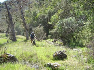
Kelly Cabin Canyon Trail
Park Condition: Perfect! The creeks are flowing, wild flowers are everywhere, and its not too hot.
Riding Condition: The trails are starting to dry up, but right now there’s minimal dust. Watch for loose dirt in areas exposed to lots of sunlight.
Population: Minimal. There were a handful of other bikers at the start of this ride, but once we got half way in we didn’t see another person for 2 hours.
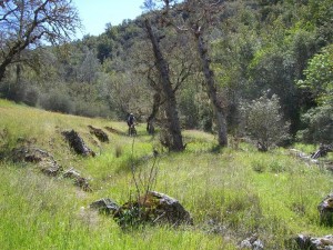
This is the best mountain bike ride I’ve ever been on! Henry Coe offers a ton of challenging single track with excellent views. Kelly Cabin Canyon Trail has just been maintenanced and is practically unridden. The trail consists of very tight single track, about 30 creek crossings, and spectacular natural meadows.
This 4 hour ride starts at the coyote creek entrance to Henry Coe. You can see the route info and all of the ride stats (elevation, duration, maps, etc…) at my garmin connect page. Be sure to click on the terrain view to see the topo version – it’s unbelievable. The Henry Coe Official Website says that trails range from “steep, to very steep, to ridiculously steep” and they mean it. You need to be in good to great shape to really ride here.
On today’s ride we encountered meadows containing a variety of 10 or more wild flowers, sprawling hillsides of Poppy flowers, and even some wild turkeys! The weather was a nice cool 65-70 degrees, and the water was comfortable (some creek crossings came up to my knees).
This is definitely a ride I’ll be doing again and again – an absolute gem that highlights why mountain biking is so awesome. Check out the flash slideshow below.
[svgallery name=”Henry Coe 04-04-2009″]
Water Dog – Saturday Morning Training Loop
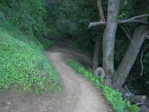
Top of Finch Trail
Park Condition: Dry- no dust
Riding Condition: Normal
Population: Crowded – I think everyone was out because it was the first nice Saturday in about a month
I hit Water Dog at 8:35 this morning. The first thing I noticed was the abundance of vehicles parked near the entrance to Lake Road Trail which was odd for early Saturday morning. It turns out that there were a lot of folks trying to get out and enjoy what was forcasted (and turned out to be) a very nice day.
I finally got my Garmin Edge 705 and this is the first ride I was able to actually log. You can see all of the detailed info on this ride at my garmin connect page. Check out the player, its a really neat way to see the ride. You can also view the terrain mode to get an idea of what the ride looks like – very cool.
Last weekend at Water Dog I had a rabbit just about kill me when it rain straight into my front wheel’s spokes. This week I was cruising along down the 18 switchbacks on Finch trail, rounded a switchback, and there was a 3′ rattlesnake sprawled across the trail. I had no time to stop so I ran over it. I must’ve surprised it because it never had a chance to coil or I would’ve been in trouble. I don’t think I hurt it too bad because it managed to slither away pretty quickly. I was shaking so bad I had a hard time negotiating the rest of the switchbacks and you can see my heart rate rise in the middle of the decent which is pretty awkward looking!
It was nice to get out and test the Edge 705 at my local stomping ground, but next week will be the real test when I go to Henry Coe.
Water Dog
Technical Difficulty: ![]()
Physical Difficulty: ![]()
Singletrack: Yes – Most of the park is tight technical singletrack but there are a few fire roads.
Parking Availability: Yes – plenty of parking is available at multiple locations
Seasonal Conditions: All trails are open year round.
Description:
Water Dog (officially Water Dog Lake Park) is a post-work gem for folks living on the SF Penninsula. This tiny park offers a large range of technically challenging terrain and obstacles. Cell phone coverage is good so if you’re looking for a place to ride solo this is a good option.
It’s amazing how in-touch with nature you can be at this mountain oasis in the middle of suburbia. The outermost trails are surrounded by houses, but it doesn’t feel like you’re riding through people’s back yards either.
Directions:
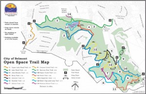
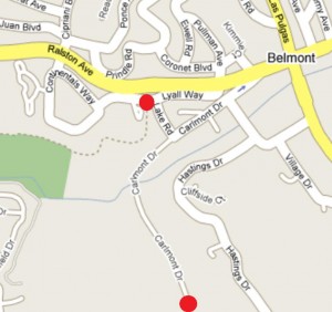
From US 101 take Ralston ave west. You’ll go through Belmont and up the mountain. Take a Left onto Lyal Way, your next left onto Lake, and then a Right onto Carlemont. Parking is at the end of Carlmemont (about .25 miles) Remember that the park is surrounded by suburbia so it may not feel like you’re going the right way, but you are.
From 280 take 92 East and then the first exit onto Ralston Ave. The off-ramp puts you at a light – go left (up over the top of the hill). Turn right onto Continentals, make a quick left at they “Y” and then your first left onto Lyall. A quick right onto Lake and at the bottom of the hill turn right onto Carlemont. Continue to the end of the road (about .5 miles) to the parking lot.
[svgallery name=”WaterDog”]
Water Dog Again – Morning Ride
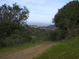
Water Dog - Fireroad Warmup
Park Condition: Moist – Not lots of mud, but the ground is nice and sticky with no dust
Riding Condition: Fast
Population: Very Low
I went out early this morning before Lucy’s swim lessons so I could get in a good ride before the predicted rain hit for the weekend. There was a huge difference between Wednesday’s ride and today. The muddy corners are dry enough to be really sticky, there was only a few people out – all hiking with dogs, and the amount of wildlife encounters was significantly increased. I got to see about 30 rabbits and 3 flocks of grouse.
One rabbit actually ran square into the spokes in my front wheel. It happened so fast I didn’t have a chance to react, or even slow down. I’m pretty sure the little guy was hurt but he tumbled off into the brush so I don’t really know. This was a great reminder that no matter how well I’m feeling on the bike, nature needs to be respected.
I was able to ride the same route as Wednesday in 1 hour 15 minutes instead of 2 hours. I could be that I’m stronger in the mornings instead of after work but the lack of waiting around for groups of 30 riders to clear sections probably helped a bit too.
WaterDog – Wet n’ Fun
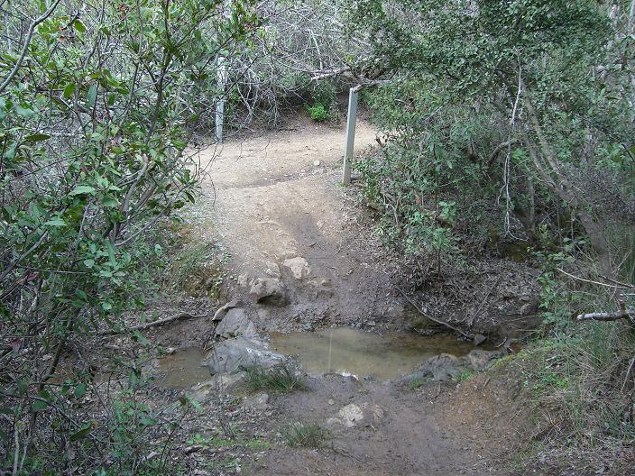
WaterD og Creek
Park Condition: Moist – Recently Cut Back
Riding Condition: Fast
Population: Crowded
I got to ride Water Dog today after work. It’s nice and green right now with enough water and mud to keep things interesting but definitely ride-able. Most of the park is still moist enough to be really sticky, but you have to watch out for mud spots in the tight corners.
I don’t have GPS data for this ride because my Garmin is still in transit. Hopefully It’ll come in by next week and I’ll have some charts to share for my upcoming Henry Coe ride.
Wednesday nights are usually packed at the dog, and this was no exception. A very large group from Passion Trail Bikes kept me stopped for a few minutes, but they’re nice guys so I really don’t mind.
Someone has recently cut back the brush which was desperately needed. This is the first time in well over a year I didn’t get whacked in the face coming down the switchbacks on Finch trail.
Also of of note is a new section on the top of Finch that connects the top of the switchbacks to the very top of Finch Trail. This is a recently cut trail and its still pretty tight so if you’re highly susceptible to poison oak you might want to avoid it.
